Buying a plot on the Alicante coast: what to survey first
Before buying a villa or plot in Xàbia (Jávea), Dénia, Moraira or Calp, a topographic survey tells you whether what you buy matches the title deed.

If you are going to buy a villa or a plot on the Alicante coast, a topographic survey before you sign tells you something that neither the listing nor the title deed (escritura) guarantees: whether what you see on the ground is what you are going to buy. In Xàbia (Jávea), Dénia, Moraira, Benissa, Calp (Calpe) or Altea it is common for the title deed, the Cadastre (Catastro, Spain’s land and property register for tax purposes) and the walls of the plot to tell three different stories. Better to find out before you pay than afterwards.
Why survey a property that already has a title deed?
Because having a deed does not mean having defined boundaries. Most title deeds describe the property with an area and with boundaries named after a neighbour or a street, without coordinates. Nobody has ever checked whether those square metres are the ones inside the fence.
The problem we want to avoid is a specific one: buying a property whose registered area does not correspond to its physical boundaries. There may be surplus land that you will not be able to register without a formal procedure, or there may be land missing that you are paying for.
What tends to turn up on the coast?
On the urbanisations of la Marina Alta and la Marina Baixa we see the same patterns again and again:
-
Plots from the 1970s and 1980s whose title deed copies the area from the developer’s sales plan, not the real measurement.
-
A displaced Cadastre on hillsides, with the plot drawn a few metres out of place or with a different shape.
-
Walls and fences that do not follow the boundary: terraces that were taken in, a path that was closed off, a corner that was rounded.
-
Undeclared buildings: a pool, an enclosed porch, an extension, a shed, which exist on the ground but not in the title deed or in the Cadastre.
-
Plots next to a ravine (barranco) or near the sea. With the plot measured in coordinates, it can be overlaid on the official demarcations of watercourses and of the coastline to see whether any part is affected. What consequences that has is for your lawyer to assess.
None of this stops you from buying, but it does change what is worth negotiating, what to require from the seller or what to regularise before signing.
What do we do before a purchase?
Measure
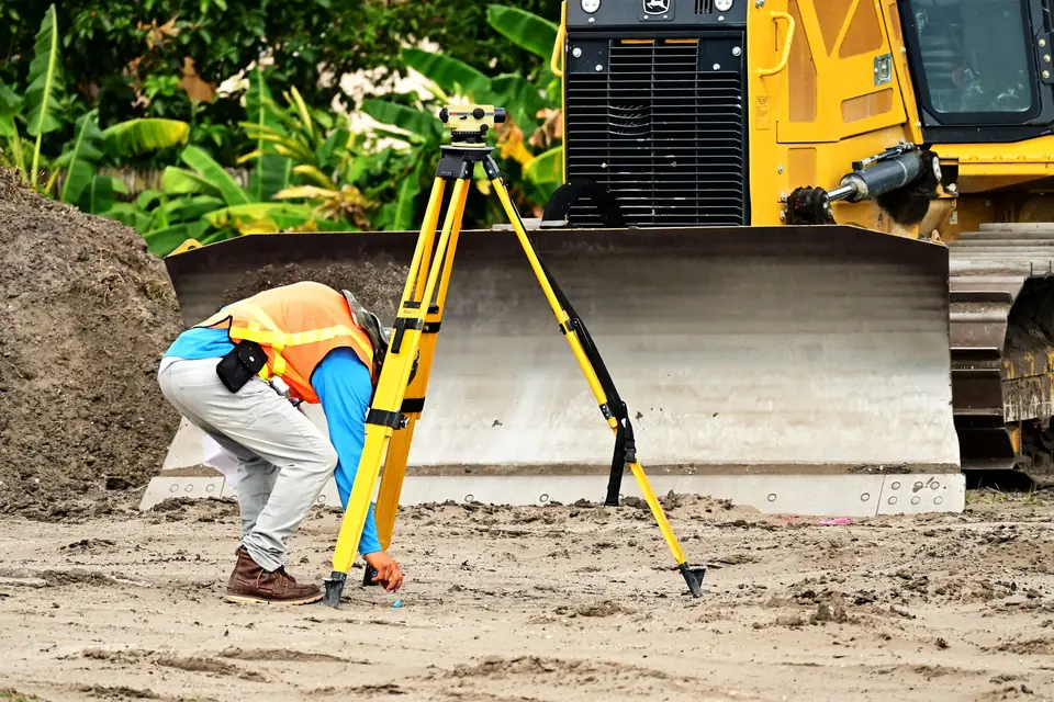
We carry out a topographic survey of the plot along the boundaries indicated by the owner or along whatever physical limits there are: walls, fences, kerbs, terraces. If there are buildings, they are measured too.
Compare
We compare the survey with the information held by the official bodies: the current and historical Cadastre, the Land Registry (Registro de la Propiedad), orthophotos and, where they exist, urbanisation plans. All in the same coordinate system.
Map
We produce the mapping of the area concerned: the measured plot overlaid on each of those sources, so that you can see where they match and where they do not.
Report
We deliver a technical report that defines the property objectively and explains each difference. It is a document that your lawyer or your notary’s office can read and use in the negotiation.
What questions does the report answer?
- Does the real area match the one in the title deed and the one in the Cadastre?
- Are the walls and fences on the boundary, or is there land too much or too little?
- Are the buildings inside the plot and declared?
- Is the property coordinated between the Cadastre and the Land Registry?
If the answer to any of these is no, there is a solution: an excess of area (exceso de cabida) procedure, an update with the alternative graphic validation report (IVGA, Informe de Validación Gráfica Alternativa) and the cadastral building location report (ICUC), explained in IVGA and ICUC, or a boundary demarcation (deslinde) with the neighbour. What matters is deciding who resolves it and when, before signing.
What if I am buying from outside Spain?
Many buyers on the coast live abroad and come over only occasionally. The survey can be done without you being there: the seller or the estate agent shows us the property, we measure it and we send you the report with clear plans, which your lawyer can go through with you. The important thing is to commission it in good time, before the signing dates become pressing.
In why you should measure a property before buying it you will find the general approach. This article focuses on what we see on the coast.
Frequently asked questions
Does the notary not check this already?
The notary checks ownership, charges and the registered description, but does not measure the property. If the title deed states an area, the notary does not know whether that area is inside the fence.
What about the bank’s valuation?
The valuation puts a value on the property, but it is not a topographic survey and it does not define the boundaries in coordinates.
When should the survey be commissioned?
Before the deposit contract (contrato de arras) or, at the latest, before signing in front of the notary. If a difference turns up, there is still room to negotiate or for the seller to regularise it.
We measure plots and villas in Xàbia, Dénia, Teulada-Moraira, Benissa, Calp and Altea from our base in Xàbia. Start with a plot measurement and boundary survey and, if regularisation is needed, we prepare the documentation for the Cadastre and the Land Registry.
Tags levantamiento topograficopropiedadcatastroregistro de la propiedad
Written by Vicent Doménech, geodesy and cartography engineer, chartered surveyor no. 8948.