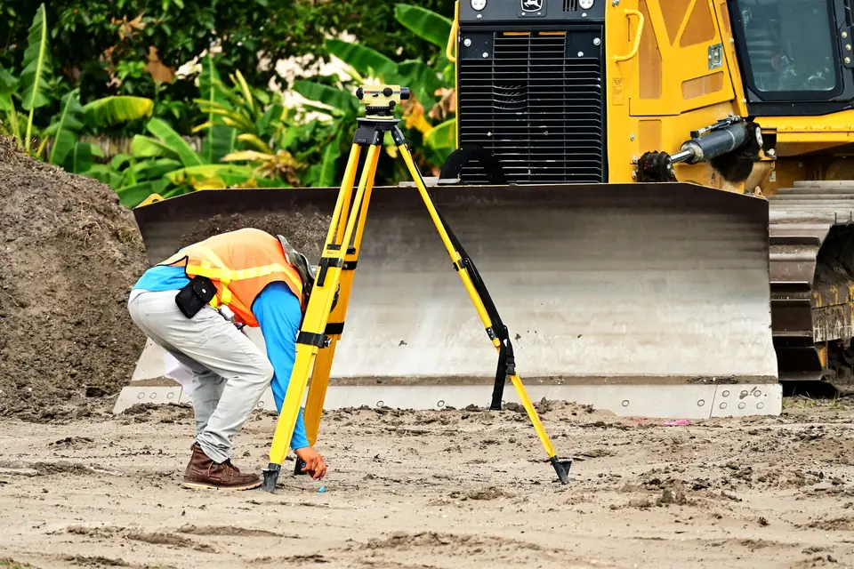
Topographic plan for an architect: what it includes
Buildings, pool, walls, steps, trees, services, inspection chambers and contour lines: what a topographic plan must show to design on a plot.

A topographic plan for an architect is not a drawing of the perimeter with four spot levels. It is an exact picture of what is on the plot before anything is touched: every building, every wall, every tree, every inspection chamber and the shape of the ground. If something is missing, it turns up on site, and on site everything costs more. This is the plan we delivered for a plot with a house in l’Horta Sud, south of Valencia, and what is worth asking for.
What should the plan show?
What an architect needs to know about the plot falls into four groups:
Boundaries
- Plot perimeter, with fences, walls and enclosures.
- Adjoining roads and access points.
Buildings and structures
- House, porches and terraces.
- Swimming pool, sheds and other structures.
- Steps, ramps and retaining walls.
Services and utilities
- Water, drains and inspection chambers or manhole covers.
- Electricity and lighting, with poles and lamps.
- Telephone and telecommunications.
Ground and vegetation
- Ground levels and contour lines.
- Trees, with their position and, if requested, their canopy.
Each element with its position and the precision with which it was measured. That last point matters: the architect needs to know what can be taken as exact and what is approximate.
The case: a plot with a house in l’Horta Sud
A plot with a house, a pool and a good number of trees was going to be the subject of a project. The architect needed to know every existing element: the building, the pool, the terraces, the steps, the walls, the lighting, the telephone line, the drains, the water connections, the vegetation, the manhole covers, the levels and the relief.
How we measured it
We combined three techniques:
- Classic surveying, with GNSS RTK and a total station, for the elements that demand the most precision: building corners, walls, pool edges, inspection chambers.
- A photogrammetric drone flight, for the orthophoto of the whole plot.
- LiDAR, for the relief under the trees.
How we processed it
With the field data, the assembled orthophoto and the processed point cloud, we located each element and obtained the DTM (digital terrain model), the DSM (digital surface model), the difference between the two (the height of whatever stands on the ground) and the contour lines.
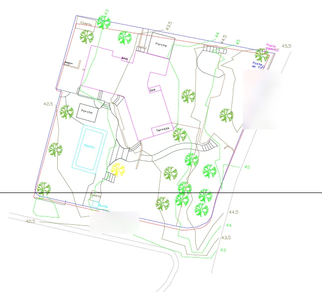
What we delivered
A topographic plan showing each of the elements with its precision.
What it was used for
It is the base on which any work on the plot is defined and planned. On a plan like this you decide where you can build, which walls are kept, how access is resolved and where the water drains to.
Why combine classic surveying, drone and LiDAR?
Because each technique is good at something different. The total station gives precision on the hard elements. Photogrammetry gives a complete, measurable image of the plot. LiDAR gives the ground where the camera only sees treetops. On a plot with an established garden, using only one leaves gaps.
What an incomplete plan usually leaves out
- Only the perimeter and the building, without inspection chambers or services. Then the trench for the extension runs into a drain nobody drew.
- Scattered spot levels without contour lines, or contours taken from general mapping that do not represent the plot.
- Trees not located, when they determine where you can dig and some town councils ask for justification of the ones being kept.
- No official coordinates, which means the plan cannot be overlaid on the Cadastre (Catastro, Spain’s land and property register for tax purposes) or on the planning maps.
What should you tell the land surveyor before the survey?
A useful plan starts with a good brief. Before the visit, it helps us to know:
- What is going to be designed: a new house, an extension, a pool or a garden redesign.
- How far to measure: just the plot, or also the pavement, the road and the service connections, which affect access levels and utilities.
- What level of detail the architect needs for trees, walls or finished floor levels.
- What format the practice works in, so that the plan is delivered ready to draw on.
If the project will also need ground profiles, we explain them in longitudinal profiles and cross sections. And in land surveying for architecture you will find the general approach.
Frequently asked questions
What contour interval do I need for a house?
For a residential plot we usually work with contours every half metre, as in this case, or every metre if the ground is flat. We adjust it with the architect.
Does the inside of the house need to be measured?
For a topographic plan, no: we measure the external footprint and the access levels. If the project is an interior refurbishment, that is a separate architectural survey.
Can I also use it for the Cadastre?
The survey, yes, because it is in official coordinates. From it we can generate the GML file (the georeferenced parcel format the Cadastre and the Land Registry require) for the plot, or for the buildings if they need updating.
If you are going to design on a plot, commission the plan before you start drawing. We produce it as part of our topographic surveys and, where there are trees or a lot of relief, with LiDAR and point clouds.
Tags levantamiento topograficoplanotopografiaprecision
Written by Vicent Doménech, geodesy and cartography engineer, chartered surveyor no. 8948.