Earthworks volume with drone and LiDAR: the calculation
How excavated volume is calculated by subtracting two terrain models, with the case of an opencast site in the Vall d'Albaida surveyed with drone and LiDAR.

Earthworks control answers a simple question: how much soil or rock has left this place between one date and another. To answer it with data and not by eye, the ground is measured twice and the two models are compared. With drone and LiDAR, that control can be carried out over large areas and as often as the works or the operation require. We explain it with the case of an opencast site in the Vall d’Albaida.
How are earthworks calculated?
The idea is always the same: compare two surfaces.
- A digital terrain model (DTM) is obtained on the initial date.
- Another DTM is obtained on the final date, or the design ground surface is used.
- The two models are subtracted point by point. Where the second is lower, there is excavation or cut; where it is higher, there is fill or embankment.
- That difference in levels is integrated over the area, and the result is the volume.
There is one condition that cannot be skipped: both models must be in the same coordinate system and based on the same control points. If one was measured from a different base, the subtraction mixes the real movement with the fitting error and the volume is no longer reliable. That is why, in periodic control, the reference stays the same on every date.
The traditional method did the same with cross sections at set intervals and a calculation between sections. It works well on linear works, and we describe it in longitudinal and cross sections. On large, irregular surfaces such as a quarry, comparing complete models is more reliable, because it does not leave unmeasured areas between one section and the next.
Why with drone and LiDAR?
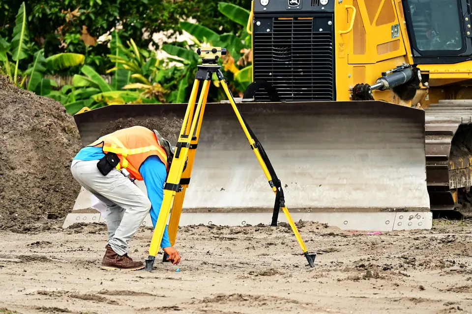
Surveying an opencast site with a total station means walking along slopes and berms, with the risk and the time that involves. With a drone:
- Photogrammetry provides the orthophoto, which leaves a visual record of how the site looked that day.
- LiDAR provides a dense point cloud from which the DTM is built, even in the scrub-covered areas along the edge.
- It is repeated in the same way every time: same flight, same control points, same coordinate system. That is what makes the dates comparable.
The case: monitoring an excavation in the Vall d’Albaida
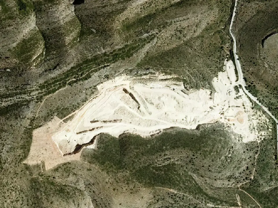
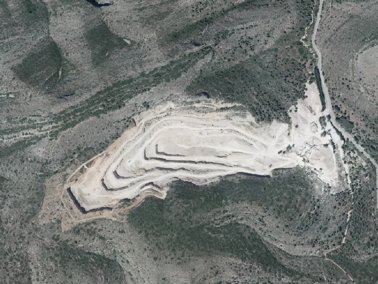
At an opencast site, the excavation had to be monitored over time: how much material had been extracted between two points in time, and where.
What we did in the field
A photogrammetric and LiDAR flight on each control date, with control points measured on the ground.
What we analysed
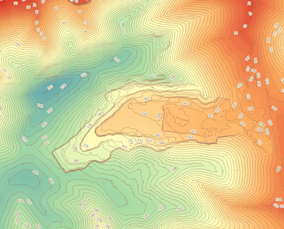
From each LiDAR point cloud we obtained the DTM of the site and its contour lines.
How we processed it
We subtracted the models from the two dates and calculated the volumes. The result is a map of level differences: each point shows how much the ground has gone down or up.
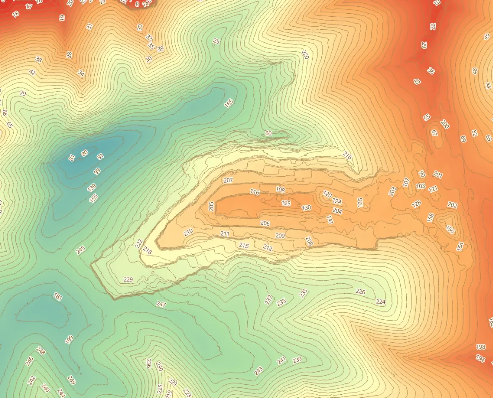
What we delivered
- The DTM for each date.
- The orthophotos.
- A technical report setting out the difference in ground levels, that is, the excavation carried out, with its volume.
What it was used for
To monitor how the earthworks progressed: knowing how much had been excavated, where and at what rate, with repeatable data at each control.
How accurate is the calculation?
It depends on three things: the point density of the model, the quality of the control points and the classification of the point cloud (removing machinery, temporary stockpiles or vegetation when they are not part of the ground). If both dates are measured with the same method and the same coordinate system, errors remain under control and the comparison is reliable.
Who is it useful for?
- Quarries and extraction sites, to know the volume extracted between periods.
- Works involving excavation or embankment, to certify quantities and check that the work follows the design.
- Properties that need to document earthworks carried out by third parties.
Frequently asked questions
How often should we fly?
That is set by whoever needs the data: on a construction project, at the certification milestones; at an extraction site, as often as its monitoring requires. What matters is that the method is always the same.
Can the volume be calculated if there is no initial survey?
Sometimes, yes, by using public data or an old survey as the first model, bearing in mind that its accuracy is lower. Ideally, the ground is measured before work starts.
What is the difference between cut and excavation?
In practice they are used almost as synonyms: both mean material that is removed. Cut (desmonte) usually refers to lowering the ground in the open, while excavation also includes trenches, basement digs and pits.
If you need to measure or monitor earthworks, we do it as part of volume calculation and earthworks with LiDAR and point clouds.
Tags levantamiento topograficotopografiadatosprecision
Written by Vicent Doménech, geodesy and cartography engineer, chartered surveyor no. 8948.