Land surveyor in Alicante
Alicante province is not measured the same way everywhere. In the Marina Alta and the Marina Baixa we work on hillside villas, terraces and the coastal protection line (Costas). In l'Alacantí and the Vega Baja the huerta (the irrigated market-garden land), the ravines and the 1970s urbanisations come into play. We are land surveyors in Alicante with an office in Xàbia (Jávea), and from there we cover the whole province.
- Land surveying services in Alicante
- Plot and boundary surveys
- Cadastre and Land Registry: GML and IVGA
- ICUC and certificates of age
- Surveys for architects
- Costas and watercourse constraints
- Setting out and construction control
- Nearest office
- C/ Ausiàs March, 2, 03730 Xàbia (Alicante)
The northern coast: villas, slopes and Costas
From Dénia to Benidorm, the Alicante coastline is cliffs, coves and pine-covered hillsides. Many of the enquiries we receive come from villa owners, a good number of them residents from northern Europe, and from the studios that design or renovate those houses. The same issues keep coming up: plots in old urbanisations whose plan does not match the Cadastre (Catastro, Spain's land and property register for tax purposes), extensions that were never declared, retaining walls that act as the boundary, and the coastal protection easement (Costas) on frontline plots.
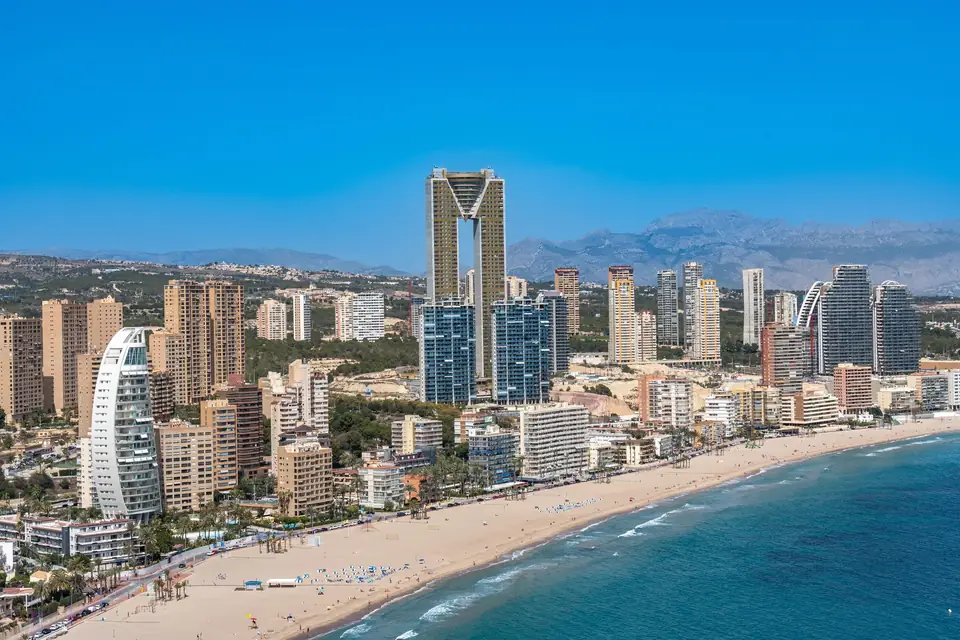
In Xàbia, Dénia, Teulada and Moraira, Benissa, Calp (Calpe), Altea and Benidorm, every municipality has its particularities: a hillside on the Montgó is not surveyed like a cove in Benissa or a plot between the towers of Benidorm. Here is what applies across the whole province.
Alicante city, the huerta and Cabo de las Huertas
In and around the city, consolidated urban land sits alongside the old estates of the Alicante huerta, with their defensive towers and country houses between Sant Joan and El Campello, and the urbanisations of Cabo de las Huertas and San Juan beach. We survey building plots for projects, check areas in sales and resolve discrepancies between the Cadastre and the Land Registry (Registro de la Propiedad) on properties that have not been measured in a century.
Inland and the Vega Baja: tahúllas, ramblas and dry land
Further inland, in l'Alcoià, el Comtat or the Vinalopó, the work is rural estates, industrial units on business parks and country houses with olive trees and vines. In the Vega Baja, huerta plots are still described in tahúllas (the old local land measure) and the water arrives through irrigation channels fed by the Segura. There the river basin authority responsible for watercourses is no longer the Confederación Hidrográfica del Júcar but the Confederación Hidrográfica del Segura, and that changes who you have to ask for permission to build next to a rambla (a dry riverbed).
On the southern coast, from Torrevieja to Orihuela Costa, the most common enquiry concerns a sale: enclosed terraces, solariums and pools that the Cadastre does not show, and owners who live abroad.
Cadastre and Land Registry in Alicante: which document you need
To correct the area or the shape of a property in the Land Registry, the technical document is a georeferenced graphic representation as a GML file (the georeferenced parcel format the Cadastre and the Land Registry require), with an alternative graphic validation report (IVGA) when it does not match the cadastral one. To register a new house or an extension, the notary asks for the cadastral building location report (ICUC), which places the building inside the plot with coordinates. If the building is old, a technical certificate of age is added.
To design, the architect needs a topographic survey with contour lines and every feature on the plot; to build, a setting out that transfers the project onto the ground. None of these documents proves ownership: the title and the Land Registry do that. What they achieve is an exact description of your property.
Excess of area: when the property is larger than the deeds say
In this province it is common to find properties with an excess of area (exceso de cabida), more square metres than the title deed states, especially in the countryside and on plots subdivided decades ago. If the difference is small, the route is short. If it exceeds 10% of the registered area, a formal procedure is needed in which the neighbours are summoned, and the survey has to be especially well documented.
We prepare it knowing that it will be reviewed by the notary, the land registrar and, sometimes, the neighbour's lawyer.
Typical cases in Alicante
A foreign buyer who wants to know, before signing, whether the villa they are buying in the Marina Alta is correctly described in the Land Registry. A law firm that needs an expert surveying report on a boundary of a property in the Vinalopó. An Alicante architecture studio that commissions the survey of a building plot near San Juan beach. A group of heirs dividing a huerta property in the Vega Baja described in tahúllas.
Official cadastral map
Alicante, plot by plot
Every line on this map is a boundary as the Cadastre draws it. Before we visit a property we overlay it with the deeds, the orthophoto and what is really on the ground: the wall, the fence, the terrace. There is almost always a difference, and that is where our work begins.
Move the pointer over the map to read the real UTM coordinates (ETRS89, zone 30). The highlighted plot is an example, not a client’s.
Tell us about your case
The whole province, from Xàbia
Tell us which municipality the property is in and what you want to resolve. We will reply with what needs to be measured and which document you will receive.
- Xàtiva
- C/ Ballesters Navarresos, 7 · 46800 Xàtiva
- Xàbia
- C/ Ausiàs March, 2 · 03730 Xàbia
- or write to
- hola@clotoides.com