Land surveyor in Dénia
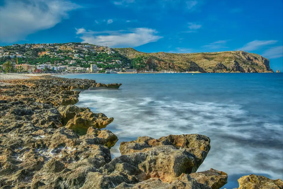
Dénia has two coastlines, and each gives a land surveyor very different work. To the south, Les Rotes: rock, pine trees and houses almost on the water. To the north, Les Marines: sand, dunes and villas that run right down to the beach. In between stands the Montgó, and behind it Jesús Pobre and La Xara among the orange groves. We measure plots and boundaries in Dénia from our office in Xàbia (Jávea), on the other side of the mountain.
- Land surveying services in Dénia
- Plot and boundary measurement
- Position relative to the Costas boundary
- GML and IVGA
- Surveys for projects on rock
- Subdivisions on rural land
- Expert surveying reports
- Nearest office
- C/ Ausiàs March, 2, 03730 Xàbia (Alicante)
Les Marines: the beach, Costas and the boundary line
On the northern coast, between the port and the boundary with Oliva, many beachfront plots are affected by the maritime-terrestrial public domain or by the coastal protection easement (Costas). The boundary itself is approved by the coastal authority (Demarcación de Costas), not by us. What we do is locate, to the centimetre, where that line falls in relation to your house, your wall or the pool you want to build.
It is a question to ask before you buy. Having part of the garden inside the easement does not stop you living in the house, but it limits what can be extended or rebuilt. We draw it on the survey with the official Costas mapping overlaid, and we explain it to you with the plan in front of us.
Les Rotes and Cap de Sant Antoni: villas on the rock
Towards the cape the ground changes completely. Narrow plots, bare rock, pine trees that cannot be touched and steep access roads. Here a topographic survey in Dénia does not stop at area and boundaries: the architect needs to know where the rock comes to the surface, which tree stands at each point and the level of every corner of the boundary, because the project has to fit between all of that.
Under the pines the GNSS loses signal, so we combine the receiver with a total station and tie both sets of measurements into the same coordinate system. For the architect, the result is a single, consistent plan.
Jesús Pobre, La Xara and the countryside
Inland, the municipality still has country houses with a riu-rau (the traditional arched porch used to dry raisins) and orange and almond groves that have passed from parents to children without anyone measuring them again. When they have to be sold or divided, the usual problems appear: the title deed (escritura) talks of hanegadas, the old local land measure, the Cadastre (Catastro, Spain's land and property register for tax purposes) talks of square metres, and every neighbour remembers the boundary in their own way.
We carry out the boundary demarcation (deslinde) on site and prepare the plot subdivision (segregación) with its GML files (the georeferenced parcel format the Cadastre and the Land Registry require). On rural land the law limits how a property can be divided, and we tell you before we start whether yours can be split the way you want.
Cadastre and Land Registry in Dénia: when you are asked for an IVGA
If the area of your property in the Land Registry (Registro de la Propiedad) does not match the area in the Cadastre, the notary or the registrar will ask you for a georeferenced graphic representation. When our measurement does not match the cadastral drawing, that representation comes with the alternative graphic validation report (IVGA), issued through the Cadastre's online portal. A positive IVGA means the drawing is technically correct and does not overlap the neighbours. It does not say the property is yours: that is for your title and the Land Registry.
Typical cases in Dénia
A house in Les Marines that the owners want to extend, with a garden that touches the Costas easement. A plot in Les Rotes where the architect needs the levels of the rock and of every pine before drawing anything. Three siblings who inherit an orange grove in La Xara and want to divide it. A buyer who discovers that the title deed gives the plot quite a few more metres than the Cadastre.
Official cadastral map
Dénia, plot by plot
Every line on this map is a boundary as the Cadastre draws it. Before we visit a property we overlay it with the deeds, the orthophoto and what is really on the ground: the wall, the fence, the terrace. There is almost always a difference, and that is where our work begins.
Move the pointer over the map to read the real UTM coordinates (ETRS89, zone 30). The highlighted plot is an example, not a client’s.
Tell us about your case
A property in Dénia and a plan that leaves no doubt
Tell us where it is and what you need to resolve. From Xàbia we cross the Montgó to see it.
- Xàtiva
- C/ Ballesters Navarresos, 7 · 46800 Xàtiva
- Xàbia
- C/ Ausiàs March, 2 · 03730 Xàbia
- or write to
- hola@clotoides.com