Land surveyor in Albacete
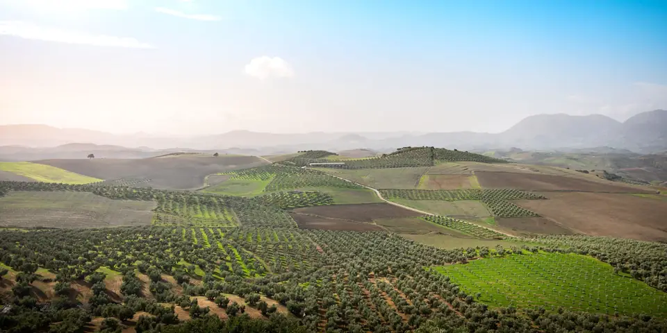
In Albacete, properties are measured in hectares, not square metres. The plains of La Mancha, the vineyards of Almansa and La Manchuela, centre-pivot irrigation and the solar and wind farms of recent years call for surveying on a different scale. As land surveyors in Albacete we work for landowners, lawyers, farming businesses and renewable energy developers, from our base in Xàtiva.
- Land surveying services in Albacete
- Rural estate measurement
- Boundaries and boundary marking
- Plot subdivisions and mergers
- GML and IVGA
- Surveying for solar plants
- Orthophoto and DTM by drone
- Nearest office
- C/ Ballesters Navarresos, 7, 46800 Xàtiva (Valencia)
Large estates, old deeds
Many estates in Albacete carry deeds with areas in fanegas or celemines, units that did not even measure the same in every village. Where there was land consolidation (concentración parcelaria) the mapping was redone, but the Land Registry (Registro de la Propiedad) often keeps the old description. The result: differences of several hectares between what is registered, what the Cadastre (Catastro, Spain's land and property register for tax purposes) shows and what is on the ground.
We measure the estate with GNSS RTK by walking the boundaries, using whatever boundary stones, tracks and earth banks remain, and if it is very large we add a drone flight with an orthophoto of the whole area. With that we prepare the GML file (the georeferenced parcel format the Cadastre and the Land Registry require), the alternative graphic validation report (IVGA) and, if needed, the documents for an excess of area (exceso de cabida) application.
We are often asked how long it takes to measure 50 hectares. It depends more on the state of the boundaries than on the area: an estate with visible boundary stones and clear tracks is measured quickly; one whose boundaries are lost among earth banks has to be walked patiently and, sometimes, talked over with the neighbours.
Solar plants and wind farms
In just a few years, Albacete has filled up with solar and wind projects. A solar plant needs a digital terrain model of the whole site, a study of slopes and run-off, and a check of the boundaries with the leased properties, which sometimes belong to dozens of different owners.
We fly an RTK drone, generate the DTM and the orthophoto, and deliver the mapping in the engineer's formats: DWG, SHP, GeoTIFF or LandXML.
Irrigation, wells and tracks
On the irrigated land of La Mancha, centre pivots, reservoirs and service tracks have changed the shape of many properties. When a farm is bought, leased or inherited, it is worth having a plan that shows what is really there: plots, buildings, reservoirs, tracks and rights of way. It is the basis for negotiating and for registering.
Drove roads, tracks and watercourses
In the Albacete countryside many boundaries are not with another owner but with public land: a municipal track, a drove road (vía pecuaria) or a watercourse. The cañadas and veredas that cross the province have legal widths that are not always respected on the ground, and their demarcation is the responsibility of the regional government, the Junta de Comunidades de Castilla-La Mancha.
When the property borders one of them, we locate it in relation to the official route and tell you whether any metres are in dispute before you register or sell.
Topographic survey in Albacete for warehouses and homes
In the city, Hellín, Villarrobledo, Almansa or La Roda we also work for architects and builders: surveys of building plots and of agricultural and industrial buildings, setting out and earthworks control.
Reports for lawyers and notaries
Boundary disputes over large estates are often settled with old aerial photographs. We prepare expert surveying reports on how the property has changed, based on historical flights, the current measurement and cadastral mapping from different periods, signed by Vicent Doménech, chartered surveyor (colegiado) no. 8948.
Typical cases in Albacete
A family that inherits a cereal estate described in fanegas and finds that the Cadastre gives it two hectares less. A solar plant developer who needs the DTM of the whole leased area. A lawyer who has to show where a boundary ran before a land consolidation. A farmer buying an irrigated estate who wants a plan with the wells, reservoirs and tracks.
Official cadastral map
Albacete, plot by plot
Every line on this map is a boundary as the Cadastre draws it. Before we visit a property we overlay it with the deeds, the orthophoto and what is really on the ground: the wall, the fence, the terrace. There is almost always a difference, and that is where our work begins.
Move the pointer over the map to read the real UTM coordinates (ETRS89, zone 30). The highlighted plot is an example, not a client’s.
Tell us about your case
Large estates in Albacete
Tell us the approximate area and what you need to resolve. We will tell you whether it is best measured with GNSS, by drone or with a combination of both.
- Xàtiva
- C/ Ballesters Navarresos, 7 · 46800 Xàtiva
- Xàbia
- C/ Ausiàs March, 2 · 03730 Xàbia
- or write to
- hola@clotoides.com