Why a 3D model: the digital twin of a historic façade
Photogrammetry with a metric camera and classical land surveying to obtain the 3D model and the plan of a historic façade before designing its restoration.
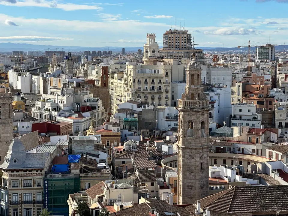
A 3D model of a building is a digital copy you can measure: every stone, every moulding and every opening in its real position. When a historic façade has to be restored, that model, the so-called digital twin, makes it possible to study and design on the building without scaffolding and without touching it. This is the case of the façade of a historic building that needed a preliminary restoration design.
What is a digital twin of a façade?
It is a three-dimensional model that reproduces the geometry of the façade with metric precision, together with a corrected image (the ortho-image) on which you can measure. It is not a scale model or a render: it is a survey, only made in three dimensions and with millions of points instead of a few dozen.
From it you can obtain:
- 2D elevations to scale, ready to draw on.
- Ortho-images of each façade, without perspective distortion.
- Sections along any plane, to study lean, overhangs or thicknesses.
- Measurements of areas and lengths for budgeting.
What are the advantages over a traditional survey?
- Everything is recorded. On a decorated façade, measuring point by point with a tape or a total station forces you to choose what to measure. The model captures everything and you choose what to draw afterwards.
- The work is done from the office. The architect or the restorer can go back to the model as often as needed without returning to the building.
- Controlled precision. Because the model rests on points measured with classical surveying, you know how far it deviates from reality.
- It documents the current state. Before work on a historic building begins, there is a record of how it was.
- It allows future comparison. If the capture is repeated after the works or a few years later, the original model shows what has changed: cracks, lean, lost pieces.
The case: preliminary restoration design for a historic façade
In a town with historic heritage, the façade of a building had to be restored. Before drafting the preliminary design, the technicians needed a reliable geometric basis.
What we did on site
Two complementary tasks:
- Photographing the façade with metric cameras, with the overlap needed to reconstruct it in 3D.
- Measuring with classical surveying the ground control points (used to orient and scale the model) and the check points (set aside to verify it).
How we processed it
- Calibration of the 3D model from the photographs.
- Identification of the ground control points in the images, to place the model in its real position and scale.
- Checking the fit with the check points: if the model reproduces them within tolerance, the model is reliable.
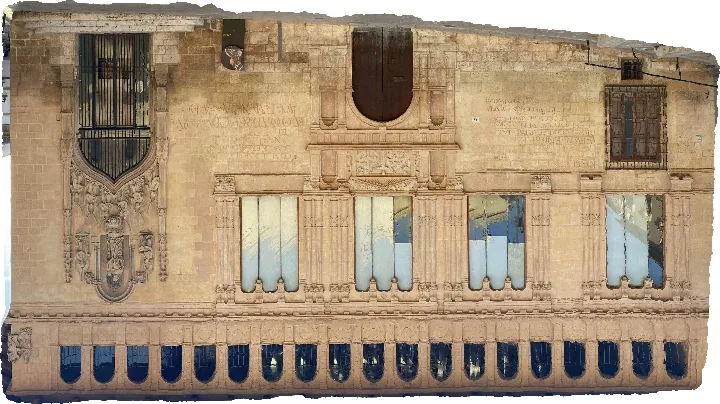
- Generation of the ortho-image of the façade.
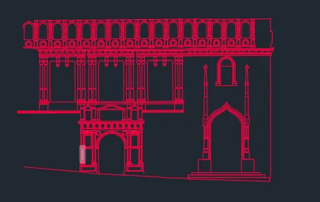
- Digitisation of the façade on the ortho-image: openings, mouldings, cornices, ironwork and decorative features.
What we delivered
- The 2D plan of the façade.
- The 3D model.
What it was used for
It was the digital twin on which the preliminary restoration design was planned: on it the defects are studied, the interventions are defined and the areas to be treated are measured.
Why are ground control points and check points needed?
Because a model made only from photographs has shape, but no reliable scale or position. The ground control points, measured with a total station, give it its size and its place. The check points, which are not used to build the model, serve to verify it afterwards. It is the difference between a pretty model and a model you can design with.
Where else is a 3D model used?
- Heritage buildings and features: façades, towers, bridges, historic walls.
- Refurbishment of existing buildings, when there are no plans or the plans are not reliable.
- Land and construction sites, where the 3D model of the terrain is used to design and to measure volumes.
In how I optimise the territory through 3D modelling and in 3D modelling of a warehouse you will find other uses.
Frequently asked questions
Is scaffolding needed to make the model?
For the photography, normally not: the façade is photographed from the ground and, if the building is tall, from raised points or with a drone where flight regulations allow it in that area.
How precise is the model?
That is set by the check against the points measured with classical surveying. It is verified on every job and stated in the delivery.
In what format is it delivered?
The 2D plan in CAD (DWG or DXF) and in PDF; the 3D model in point cloud or mesh formats that open in the usual architecture software.
We produce 3D models of buildings and land as part of our DTM, DSM and 3D models service, with photogrammetry and classical land surveying.
Tags topografiaplanoprecisiondatos
Written by Vicent Doménech, geodesy and cartography engineer, chartered surveyor no. 8948.


