A neighbour encroaching on my property: how to prove it
Cadastre, Land Registry and boundaries did not match and the neighbour refused a deslinde. How we prepared an expert surveying report to defend the plot in court.

When you believe your neighbour is encroaching on your property and they will not agree to a boundary demarcation (deslinde), the argument stops being between neighbours and becomes a matter of evidence. An expert surveying report is the way to bring that evidence to a lawyer or a judge: where the boundary is, why it is there and which documents prove it. This case, a terraced house in l’Horta Nord, shows how one is built.
How do you know where the boundaries of a plot really are?
No single document tells you. The boundary is reconstructed by putting together:
- What is on the ground: walls, party walls, façades, fences.
- What the Land Registry (Registro de la Propiedad) says: the description and the area of the registered property.
- What the Cadastre (Catastro, Spain’s land and property register for tax purposes) drew in each period, from the old topographic parcel cadastre to the current one.
- What the historical flights show: the official aerial photographs of the National Geographic Institute (Instituto Geográfico Nacional, IGN).
- The planning documents and the development plans, where they exist.
If all the sources agree, the boundary is clear. If they do not, you have to explain why, and that explanation is the core of the expert report.
The case: when nothing matched and the neighbour refused a demarcation
The owner of a house in l’Horta Nord had a problem with the adjoining owner. The Cadastre, the Land Registry and the physical boundaries gave different areas, and the series of aerial photographs did not show the boundary clearly. The neighbour did not want an amicable demarcation. The question was the usual one: is he occupying part of my land?
What we measured
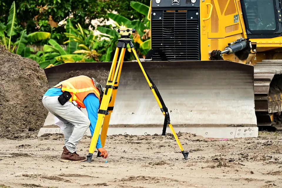
We surveyed the physical outline of the plot: façades, party walls and walls. In a terraced house the ground floor is not enough, so we also measured the flat roof, because a building does not always occupy the same footprint at the top as at the bottom.
What we analysed
We carried out a historical study of the property with:
- The historical parcel cadastre, which in this area has a version from 1971.
- The official photogrammetric series of the IGN.
- The Land Registry description.
- The physical boundaries according to our survey.
- The cadastral evolution up to the current mapping.
- The PGOU (Plan General de Ordenación Urbana, the municipal general zoning plan) and the development plans.
How we processed it
We georeferenced all the available mapping and overlaid it on the survey. This is the decisive part: a scanned 1971 plan cannot be compared with a survey made today until both are in the same coordinates.
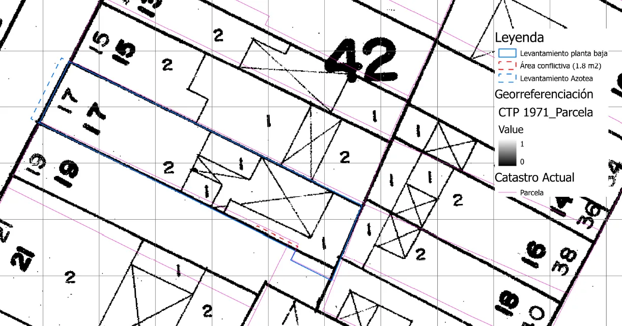
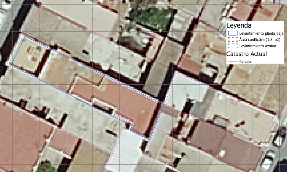
The overlay made visible what had until then been an argument: the disputed area was a narrow strip of less than two square metres along one specific stretch of the party wall. Very little land, but enough for a lawsuit if nobody defines it.
What we delivered
An expert report that defines the property objectively and clearly, with every conclusion backed by an identified source, and with plans that a judge or a lawyer can read without being a technician. Its purpose is to defend the boundaries of the registered property.
What it is for
If the dispute reaches the courts, the report is the technical evidence that justifies the boundaries of the property. And it can be useful before that: when the other side sees the overlay, the negotiation can change.
What should an expert surveying report include?
- Its own survey in official coordinates, not copied from the Cadastre.
- Every source consulted, with its date and its origin.
- Georeferenced overlays showing where the sources agree and where they do not.
- Clear conclusions, separating what is measured from what is interpreted.
- The signature of a competent technician, who can defend it if called to court.
In expert surveying reports we explain what an expert report is and who can prepare one, and in doubts about an encroachment on your property, the first steps before you reach this point.
Frequently asked questions
Can I force my neighbour to agree to a boundary demarcation?
If there is no agreement, a demarcation can be requested through the courts. Your lawyer is the person to advise you on that. What we provide is the technical evidence of where the boundary lies.
Why a historical study and not just a measurement?
Because the measurement tells you where the walls are today, but not whether they have always been there. Old flights and the old cadastre show whether a building was moved or whether a party wall was built in the wrong place.
Is it worth it for so few metres?
It depends on what is at stake. In a terraced house, a small strip can affect a wall, a window or an extension. That is why it pays to define it precisely before the problem grows.
If you suspect a neighbour is occupying part of your property, we start with a measurement of the plot and its boundaries and, if needed, a historical study with cartographic analysis.
Tags deslindepropiedadcatastrolevantamiento topografico
Written by Vicent Doménech, geodesy and cartography engineer, chartered surveyor no. 8948.