Mapping and surveying · · Updated on
Surveying equipment: total station, GNSS and drone
Which instruments a surveyor uses: total station, GNSS RTK, level, drone and LiDAR. What each one measures and when it is used on a real job.
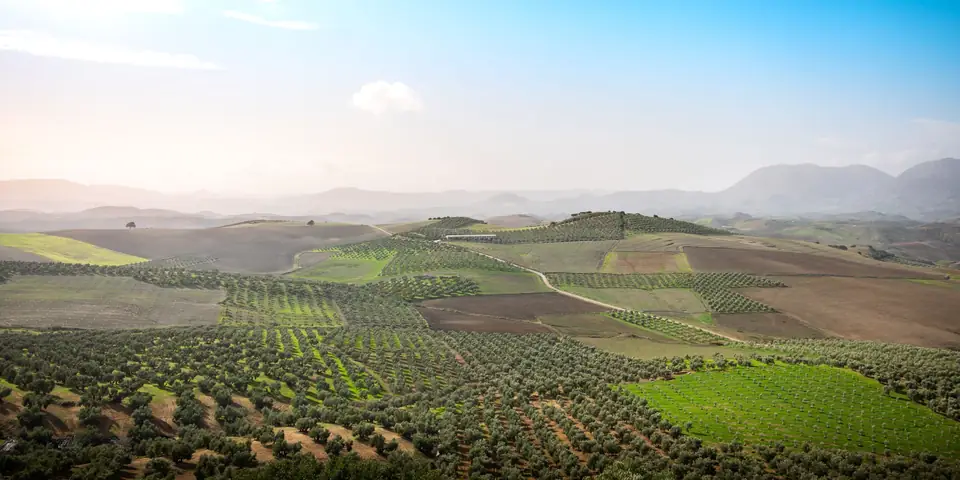
A surveyor measures with five main instruments: the total station, the GNSS RTK receiver, the level, the photogrammetric drone and LiDAR. None is better than the others; each answers a different problem on the ground, and a good job usually combines several. Here we explain what each one measures, what it is used for on a real job and when we choose it.
Almost everything a surveyor does falls into two tasks. Either reality is represented on a plan, which is a survey, or what a plan says is marked out on the ground, which is setting out. The instruments are chosen according to the precision the job calls for and the nature of the site: whether there is open sky, trees or walls, and whether the area is large.
Summary: instrument, what it measures and when it is used
| Instrument | What it measures | When it is used |
|---|---|---|
| Total station | Angles and distances | Detail, walls, buildings, setting out |
| GNSS RTK | Coordinates by satellite | Boundaries, open plots, control points |
| Level | Height differences | Site levels, grades, settlement monitoring |
| Drone | Photographs with position | Large areas, orthophoto, terrain model |
| LiDAR | 3D point cloud | Vegetated terrain, profiles, structures |
Total station
The total station is a tripod-mounted instrument that measures, very precisely, the horizontal angle, the vertical angle and the distance to a point. From those three values the instrument calculates the position of the point relative to its own location, using trigonometry. It measures towards a prism held by an assistant or, on many models, directly against a surface without a prism.
It is the instrument for fine detail. We use it when we need to:
- Measure walls, facades, corners and buildings, where a point matters to the centimetre.
- Work where GNSS fails: under tree canopy, next to a tall wall or between buildings.
- Set out: take to the ground the position of a footing, a column or a corner of the house shown in the project.
Its drawback is that it needs a direct line of sight between the instrument and the point, and that it works point by point. That is why it is not the best option for a large, open property.
GNSS RTK receiver
GNSS (global navigation satellite system) is the general name for what on a phone we call GPS. A survey receiver picks up the signals of several satellite constellations and, with the RTK (real time kinematic) correction it receives from a reference station, adjusts its position on the spot. The result is coordinates directly in ETRS89, with centimetre precision in good conditions.
We use it to:
- Measure boundaries and plot corners on open properties, such as olive, orange or dry-farmed land.
- Georeference: give official coordinates to a survey, for the Cadastre’s GML.
- Establish control points on the ground, which serve as a base for the total station, the drone or LiDAR.
Its limitation is the sky. It needs to see the satellites, so under dense trees, next to tall walls or in an inner courtyard the signal degrades. When that happens we complete the work with the total station. That is why on a property with pines and terraces it is normal to use both instruments on the same day.
Level
The level measures height differences between points with very little error. It is set up halfway between two points, a graduated staff is read at each one and the difference between the readings is the height difference. For heights it is the reference technique: more precise than GNSS, which tends to be less sharp vertically than horizontally.
We use it when the height really matters:
- Grades and site levels: the height of a slab, an access level or a pool.
- Foundations and structures: checking that slabs, floors or footings are at the height in the project.
- Settlement monitoring: measuring the height of some points again over time to know whether a structure is moving.
The level measures height only and cannot be used to draw a plan view. That is why it is used mainly on building sites, alongside the total station.
Photogrammetric drone
A drone with a camera takes hundreds of photographs of an area, each with an associated position, and the photogrammetry software combines them into an orthophoto (a photo to scale, without distortion) and a digital terrain model. From these come contour lines, profiles, volume calculations and plans of large areas. It is the tool for seeing a whole surface at once, something that would take many more data with scattered points.
We use it for:
- Large areas: big properties, quarries, landfills, urbanisations.
- Slopes that are difficult or dangerous to walk.
- Volume calculations: the volume of earth moved or stockpiled, comparing two dates.
- Progress photography of a building site.
A drone does not measure on its own. For the model to have scale and coordinates it has to be tied to control points measured with GNSS, and that is the part that gives the result its reliability. Besides, photography sees the surface: if there is dense pine woodland or a field covered in scrub, the model records the canopy, not the ground. The pilot, Vicent Doménech, holds AESA qualifications (A1, A2 and A3).
LiDAR
LiDAR emits thousands of laser pulses per second and measures how long they take to return. The result is a point cloud: millions of coordinates that reproduce the terrain and objects in three dimensions. It can be carried on a drone or placed on a tripod, depending on the scale.
Its great advantage is vegetation. The pulses pass between the branches and some of them reach the ground, so the terrain under the trees can be obtained, which photography cannot give. We use it for:
- Vegetated terrain: terraces covered in pine, slopes with scrub.
- Longitudinal and cross profiles on long plots.
- Complex structures and facades, where every detail counts.
- Estimating the volume of vegetation, as in this LiDAR case.
It is a powerful technique and not always necessary. For a flat, clear site, GNSS and the total station are enough. LiDAR is justified when vegetation or extent makes it impractical to measure point by point.
Other techniques and software
Some techniques sit apart from the five instruments above, such as ground penetrating radar, which penetrates the ground with electromagnetic waves to detect what is buried. Surveying instruments do not see what is buried, and if your case requires it we will tell you when we quote.
The data from the field is processed in CAD and geographic information system programs and delivered in formats such as DWG, DXF, GML, SHP or PDF. To find out more about that side, read about surveying software tools and the formats a surveyor delivers.
How we choose the instrument on a real job
There is no rule, but there is a criterion. An open olive grove is measured with GNSS. A plot of terraces with tall walls and pines, with GNSS where there is sky and the total station where there is not. Foundations are set out with the total station and checked with the level. A quarry or a stockpile is measured with a drone, tied to control points. And a slope covered in scrub, with LiDAR.
The first thing is to listen to what the plan is for. A survey for the architect and one for a boundary demarcation with the neighbours are not measured in the same way. If you want to see how we work, we describe it in topographic surveys, and site setting out in setting out and site control.
Frequently asked questions
Which instrument is the most precise?
It depends on what is being measured. For heights, the level. For detail, the total station. For large areas, the drone and LiDAR. On each plan we state how it was measured, because the precision a manufacturer advertises is not the accuracy of the work, which depends on the method and the terrain.
Does a drone replace the total station?
No. The drone is very good for large areas, but it does not measure with the detail of a total station and cannot be used for setting out on site. They complement each other.
Why does the surveyor use a tripod and a staff or prism?
So that the measurement comes from the instrument and not from the hand. The tripod holds it steady, and the staff or prism marks the exact point being aimed at.
How do I know which instrument my property needs?
You do not have to: we decide when we see the property and know what the plan is for. Tell us what you need and we will propose the right scope.
If you have a plot or a building site to measure, write to us from the contact page.
Tags levantamiento topograficomapaplanotopografia
Written by Vicent Doménech, geodesy and cartography engineer, chartered surveyor no. 8948.


