Topographic survey · · Updated on
Industrial surveying: buildings, pipes and machinery
What industrial surveying involves: setting out industrial buildings, surveying existing plant, pipes and machinery, extensions and checking the works.
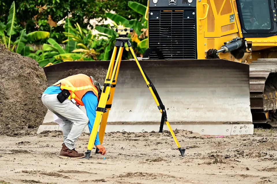
Industrial surveying is the set of measurements used to build, extend or check an industrial building, a plant installation or a machine to the tolerances that industry demands. It starts from the ground, sets out what the project says and checks that what has been built matches it. Here we explain what is measured at each stage, what is particular about existing plant and what we deliver.
What is industrial surveying?
It is construction surveying applied to an industrial setting: industrial units, plants, warehouses, silos, chimneys, pipe networks and the equipment inside them. It uses the same instruments as for a house, the total station, GNSS RTK and the level, to which laser scanning or LiDAR is added when a complex installation has to be recorded.
What changes is the demand. In an industrial building you work with grid lines, columns and floor slabs that all have to fit together, and an error of a few centimetres in the foundations can shift the whole structure. That is why almost all the work has two parts: measuring what is there and checking what is being built.
Surveying in the construction of an industrial building
The surveying team’s work runs through the whole project:
- Establishing setting-out control points. Control points are stabilised and marked around the site, outside the working area, so that everything is always measured from the same reference.
- Site survey. The current state of the ground is measured, with its levels, access and neighbours, to know the real conditions and fit the project to them. Comparing the drawings with reality makes it possible to adjust the design before digging.
- Earthworks. The earth that has to be moved to level and prepare the platform is calculated, so that the right amount of material is used and no surplus cubic metres are paid for.
- Setting out the foundations. Footings, columns, tie beams and perimeter walls are marked on the ground with their position and level. Any error here is inherited by the whole structure.
- Checking the execution. The work of the builders and erectors is verified against the project: height and position of structural elements, planimetry, verticality of columns and horizontality of slabs and beams.
The setting out and control side is covered in more detail in setting out and site control.
Surveying existing plant
Many industrial buildings were built from drawings that were never updated or have not been kept. Before extending, refurbishing or changing a production line, you need a reliable plan of what is there: slab levels, column positions, clear heights, access, roofs and fixed elements.
A conventional survey with a total station is suitable for simple layouts. If the installation is complex, with a lot of structure and equipment, it is recorded as a point cloud (laser scanner or LiDAR), from which plans, sections and heights are then extracted. We explain it in LiDAR and point clouds. It is worth knowing that what is hidden cannot be seen: buried services need the utility companies’ drawings or separate techniques.
Pipes and networks
The route of a pipe depends on two things: where it goes and at what height. A drainage or process network with gradients is built badly if the level of each section is not the one in the project. Surveying comes in at three moments:
- Before digging, setting out the route and the trench levels.
- With the trench open, checking that the grade is correct.
- Before backfilling, measuring the real position of what has been installed, because once it is covered it can no longer be seen.
That last measurement produces an as-built plan, useful for future extensions and for locating the network when needed.
Machinery, bases and structures
The position of a heavy item of equipment and its levelling are measured precisely. We check the position of bases, the horizontality of rails or footings, the alignment between machines and the verticality of towers, silos or chimneys. When a structure moves over time, repeated measurements are taken and compared; that is monitoring the deformation of a structure.
Extensions to industrial buildings
Extending a building means the new part has to match the old in level, in grid and in alignment. The work begins by measuring what exists and checking the plot limits: setbacks from boundaries, access and easements. If it is still unclear where the plot ends and the next one begins, the boundary study is the first step (we cover it in plot and boundary measurement). The extension is then set out relative to the real structure, not the old drawing.
Two examples of work on industrial installations
Here are two survey jobs we have already carried out, without names:
- The chimney of a generator set. We were asked to check whether the flue chimney was taller than the height required by legislation with respect to the neighbouring buildings. The on-site survey confirmed that the project’s restriction was met.
- The reinforced concrete silos of a cement works. Their location, geometry, diameters and heights were measured and georeferenced. With that data their current condition was known and the cost of restoration could be calculated accurately.
In both cases the survey did not solve the problem by itself: it supplied the reliable data on which to decide.
What do we deliver?
It depends on the commission, but usually:
- A plan in DWG or DXF and in PDF, with the levels, grid lines and elements agreed.
- A point cloud or 3D model, when the installation justifies it.
- Coordinate lists of the points set out or checked.
- A short report with what was measured, the deviations from the project and how it was measured.
We work in ETRS89 UTM 30N or in a local site system tied to it, and we write it on the plan. It is signed by Vicent Doménech, geodesy and cartography engineer, chartered surveyor no. 8948.
What we need from you
- The project, the drawings and the grid lines of the building or installation.
- The tolerances required by the project or by the equipment manufacturer.
- The exact location of the installation and how to get there.
- The safety rules of the site: permits, protective equipment and working hours.
Frequently asked questions
Do you need a surveyor to build an industrial building?
In practice, yes. Without setting-out control points and without checking the execution it is very hard to comply with the project, and foundation errors are among the most costly to put right.
Can an installation in operation be surveyed?
Almost always, although it depends on the installation and its safety rules. We agree it beforehand: hours, access and areas that cannot be entered.
What is the difference between a survey and setting out?
A survey measures what exists and draws it. Setting out does the opposite: it takes to the ground the position of what the plan shows. In industry both are done.
What precision is used?
The one the use requires, checked in the field. It depends on the instrument, the method and the site. We state on the plan how it was measured and what deviations were found.
If you have an industrial building, an extension or an installation to survey, tell us about it on the contact page or first read about the topographic survey.
Tags georreferenciacionlevantamiento topograficoplanopropiedadtopografia
Written by Vicent Doménech, geodesy and cartography engineer, chartered surveyor no. 8948.

