Viewshed analysis: what can be seen from a point
What a viewshed is, how it is calculated with a terrain model and what it is used for on the coast: landscape integration, siting a house or anticipating its views.
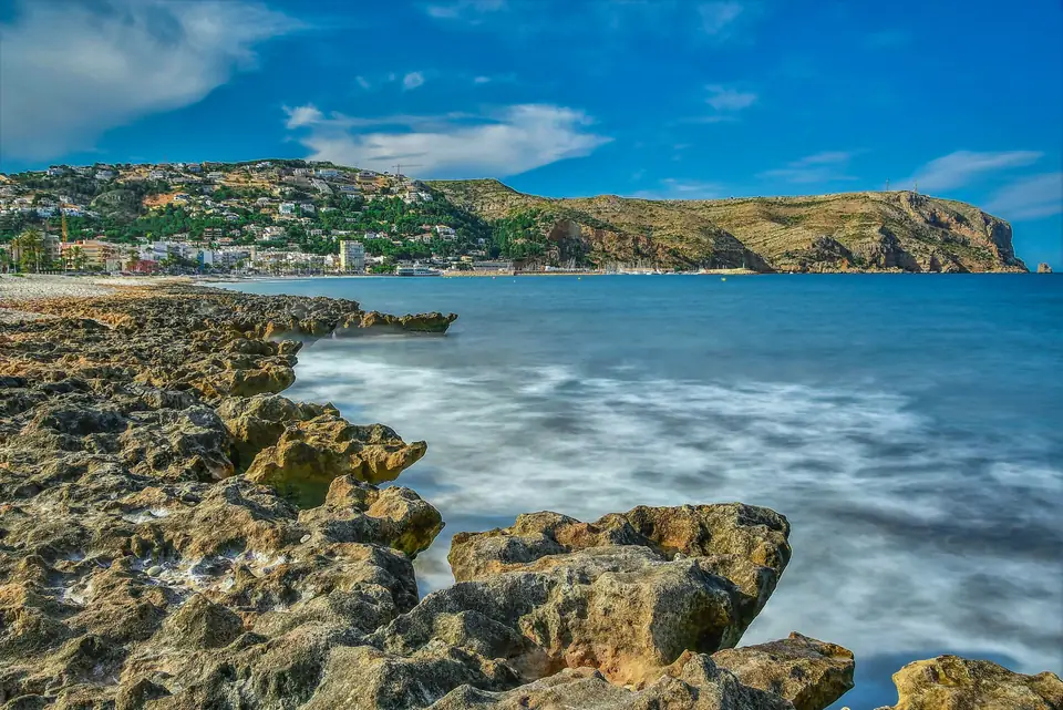
A viewshed is the part of the land that can be seen from a point. Put the other way round, it is also the set of places from which that point can be seen. On the Alicante coast, where sea views are part of the value of a plot and the landscape is protected, calculating viewsheds is a decision-making tool: where to site a house, what impact a building will have or what will still be visible in twenty years’ time.
What exactly is a viewshed?
From an observation point, a line of sight is drawn towards every point on the ground. If the relief, a building or a tree gets in the way, that point is hidden; if not, it is visible. The set of visible points is the viewshed.
In practice, the calculation is done on a digital model of the land and takes into account:
- The height of the observer: a person standing is not the same as a terrace on a second floor.
- The height of what is observed: if a building is being analysed, it is measured up to its roof, not to the ground.
- The maximum distance: beyond a certain distance, objects are no longer perceived in detail.
- The model used: with a DTM (digital terrain model), only the relief counts; with a surface model (DSM, digital surface model), buildings and vegetation count too.
This last point is the one that changes the result the most. An analysis based on the relief alone says that almost everything can be seen; one that includes buildings and trees comes close to what a person will actually see. In what an orthophoto, a DTM and a DSM are we explain the difference between the two models.
An example in Xàbia (Jávea)
The image shows the viewshed calculated from a point next to the port of Xàbia. The lit area is what can be seen from there: a large part of the plain and the coastline of the bay. What remains dark is hidden by the relief or by buildings.
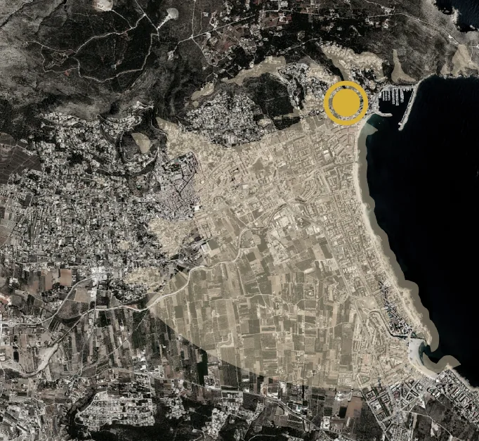
It can be read in two ways. From that point, a large part of the plain is in view. And, conversely, a tall building at that point would be visible from the whole lit area. That is the kind of question a landscape study raises.
What is a viewshed used for?
Landscape integration studies
In the Valencia region (Comunitat Valenciana), many projects on non-developable land (suelo no urbanizable) or in sensitive areas require a landscape integration study (estudio de integración paisajística). Visibility analysis is a central part of it: from which observation points (roads, towns and villages, viewpoints) the project will be seen, and how strongly. We cover it in how a landscape integration study is carried out.
Siting a house on a slope
On a plot on the coast, moving the house a few metres or raising it by half a storey can gain or lose the sea view. By calculating the viewshed from several positions and heights, the options can be compared before the design is drawn up, instead of finding out once the structure is already standing.
Knowing which views could be lost
If the plot opposite can be built on, it is possible to simulate what a building with the maximum height allowed by the planning rules would block.
Antennas, installations and viewpoints
The same calculation can be used to site antennas, cameras or installations that need to see a wide area, or to choose the best spot for a viewpoint.
What data is needed?
- An up-to-date terrain and surface model. For a single plot, the ideal is our own drone flight; for a wide-area analysis, public data is combined with detailed surveys.
- The observation points and their heights, defined together with whoever commissions the study.
- If a future building is being assessed, its volume and height.
The result can be delivered as a map in PDF and as a layer for a GIS, so that the architect or the landscape team can combine it with the rest of their analysis.
Frequently asked questions
Does the viewshed take trees into account?
If it is calculated on a surface model, yes. If only the terrain model is used, no, and the result overestimates what can be seen. That is why it is worth deciding which model to use according to the question being asked.
Can it be calculated from several points at once?
Yes. That is the usual approach in a landscape study: viewsheds are calculated from several observation points and combined to see which areas are visible from the most places.
Is it useful for a single plot or only for large studies?
For both. On a single plot, the scale is smaller and the model more detailed, but the method is the same.
We calculate viewsheds and other analyses of the land as part of our cartographic analysis and GIS service, based on digital terrain and surface models.
Tags analisismapatoma de decisiontopografia
Written by Vicent Doménech, geodesy and cartography engineer, chartered surveyor no. 8948.


