Cadastre ·
Boundary demarcation and marking: a case in Xàbia
The Cadastre and the title deed gave different areas for a plot in Xàbia. How we defined its boundaries with the urbanisation plan, the old Cadastre and our survey.

Boundary demarcation (deslinde) and boundary marking (amojonamiento) are used to establish where one property ends and the next one begins, and to leave that line marked. On the urbanisations of la Marina Alta it is a frequent enquiry: plots from the 1970s and 1980s, title deeds (escrituras) that repeat the area from the developer’s plan, and a Cadastre (Catastro, Spain’s land and property register for tax purposes) that, on many hillsides, is not where it should be. This is a real case in Xàbia (Jávea), told without any details that could identify the property.
What is boundary demarcation and what is boundary marking?
Demarcating means determining the line that separates two properties. Marking means making that line physical on the ground with boundary stones, markers or signs, so that anyone can see it. They go together because a boundary that exists only on a plan will be argued over again with the next neighbour or the next buyer.
There are two ways of getting there. The amicable way, when the adjoining owners agree and sign, or take it to the notary. And the judicial way, when they do not. In both, the technical work is the same: finding out, with evidence, where the boundary lies. If you want the general approach, it is in how to resolve boundary disputes with your neighbours.
The case: a hillside plot with two different areas
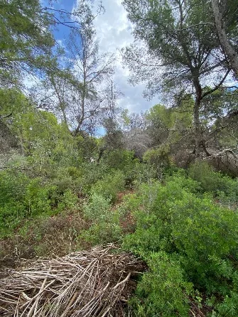
The plot was on an urbanisation in Xàbia, on a slope and with quite a lot of vegetation. The area given by the cadastral reference and the area in the title deed did not match, and that difference brought with it doubts with the neighbours about where each boundary line ran.
What we did in the field
The first step was to identify and measure the physical features that delimit the property, such as walls, terraces or fencing. On a hillside covered in pines, this step takes time, because the features are not always visible.
What information we compared
- The urbanisation plan, the mapping from which the plots were laid out.
- The historical topographic parcel cadastre (catastro topográfico parcelario) and the cadastral advance maps (avances catastrales), to see how the plot has been drawn over the years.
- The Town Council’s municipal plan (PGOU, the general urban development plan).
- The title deed, with its area and its boundaries.
- Our topographic survey.
Everything was georeferenced in official coordinates and overlaid. That way you can see which source departs from the others, and by how much.
What we delivered
A technical report in three parts:
- The unambiguous location of the plot in official coordinates.
- The spatio-temporal evolution of the plot, with mapping from different periods.
- The survey with the physical features that delimit the plot.
This report was what the owners needed to process the coordination with the Land Registry (Registro de la Propiedad) through the notary.
How it ended
The property was coordinated in the Land Registry with its graphic representation defined. With that common description, the discrepancies with the neighbours were resolved. The report was the technical basis; the registration was the step that gave it legal effect.
Why is the Cadastre so often wrong on coastal urbanisations?
Because many were mapped from the developer’s plans or from low-resolution flights, and the hillside complicates everything. In la Marina Alta it is not unusual to find plots displaced from where they really are, or drawn with the shape of the sales plan and not that of what was built. It is not the owner’s fault, but it does become the owner’s problem when selling, inheriting or wanting to extend.
When does the boundary need to be marked on the ground?
When you are going to fence, build close to the boundary line or when there has been friction with a neighbour. Once the boundary has been defined, we return to the property and set out the vertices: we leave them marked so that you, your neighbour or the builder can see exactly where it runs. If you are thinking of enclosing the plot, in fencing your property’s plot we explain what is worth checking beforehand.
Frequently asked questions
Does the neighbour have to sign the demarcation?
If it is an amicable demarcation, yes: the adjoining owners state their agreement, usually before a notary. If there is no agreement, the demarcation is settled through the courts and the technical report is submitted as evidence.
Which carries more weight, the Cadastre or the title deed?
Neither of them prevails on its own over what is on the ground. The Cadastre is an administrative reference and the title deed a legal description that may be imprecise. What we do is measure and compare all the sources to see which one describes reality.
Is the urbanisation plan useful?
Yes, very. It is the document from which the plots were laid out. Once georeferenced and overlaid on the survey, it shows whether a plot has shifted from its original layout.
If you have a plot in Xàbia or elsewhere in la Marina Alta with uncertain boundaries, we start with a plot measurement and boundary survey and prepare the documentation for Cadastre and Land Registry coordination. We also work from our base in Xàbia.
Tags deslindecatastronotariogeorreferenciacion
Written by Vicent Doménech, geodesy and cartography engineer, chartered surveyor no. 8948.

